Years ago I was introduced to backpacking and backcountry camping on the trails surrounding the landform known as The Sleeping Giant in Northwestern Ontario. During high school and on breaks from University I spent many nights sleeping in the shadows of this mythical man who rests along the northwest shore of Lake Superior. Fast forward to the present, and for years I have longed to get back on these trails as a runner, and move through these woods more quickly.
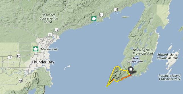
Our route around the Sleeping Giant
Recently I was back in Thunder Bay for a visit and made a (loose) plan with my brother and a good friend to do a trail run around the whole Giant. Despite weeks of discussion, it wasn’t until the drive out to Sleeping Giant Provincial Park that we finally nailed down our route – we would begin at the Kabeyun Trailhead, head west to Sawyer Bay, then south along the shore of the Lake, before traversing over the feet, and heading back to the trailhead along the Kabeyun Trail. I roughly estimated this at 25-30km which would work well (we hoped) for all of us.
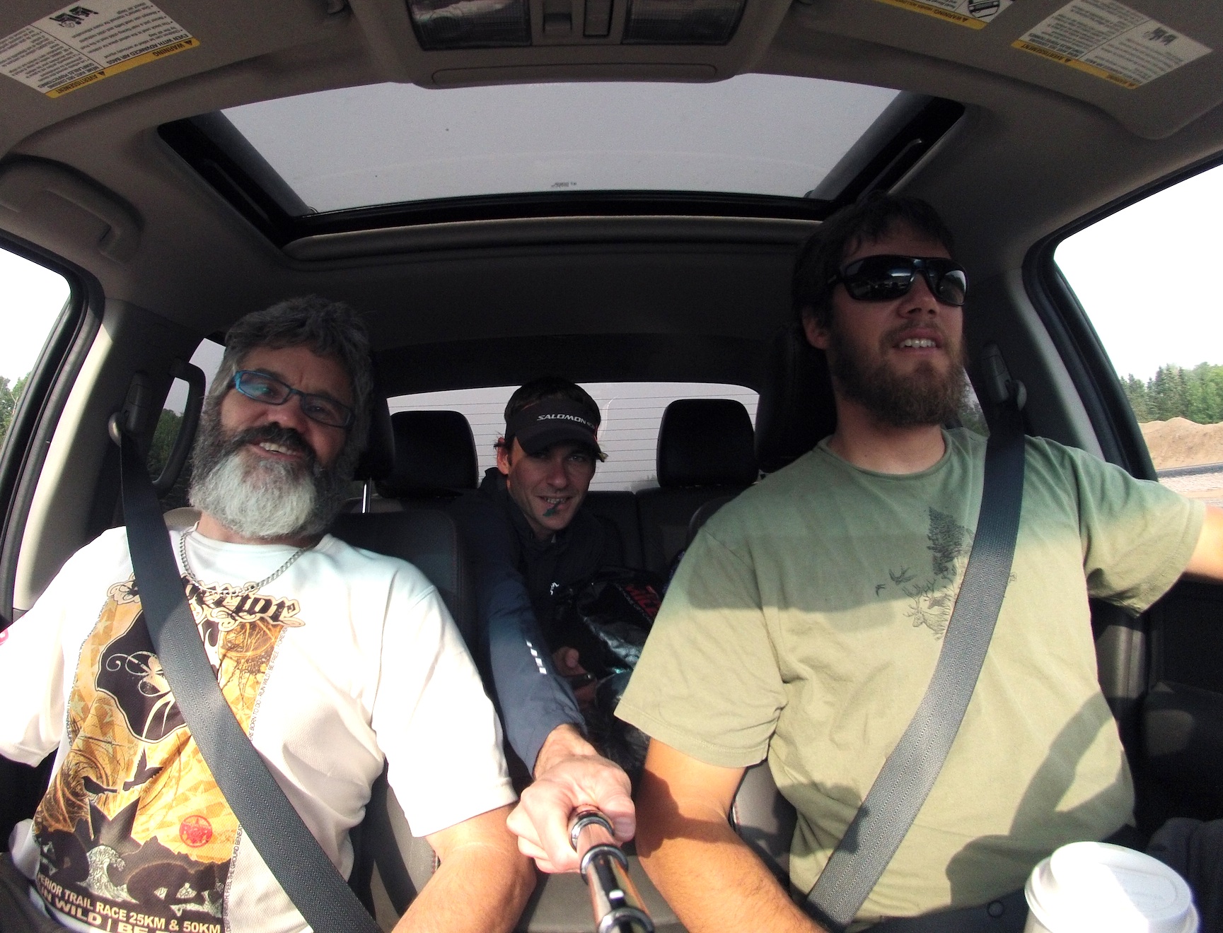
My favourite crew of runners making the most of a borrowed tank of gas
We enjoyed some coffee and laughs on the drive out to the park, and some momentary fugitivism (is that a word? The act of being a fugitive?) as we realized that no one had paid for the gas we filled the truck up with. We sorted that issue out via iphones and smooth talking and were soon gearing up at the trailhead. Our group definitely had a mismatched pacing strategy for this portion of the trip, and it took a while for part (1/3) of the team to get organized. Eventually we got sorted and headed out on our Sleeping Giant circumnavigation.

Easy trails and lots of laughs into Sawyer Bay
The first section was about 6km into the Sawyer Bay campsite. This portion was relatively easy going on doubletrack with some gentle ups and downs. The trail was in good shape and we had a great warmup for the day. Everyone was feeling good, the sun was shining, and the laughs continued.

The Kabeyun Trail on the east side of the Giant was all singletrack
Moving onto the Kabeyun Trail, we headed out around Sawyer Bay then turned south and began the long stretch from the head of the Giant, down to its feet. This section was about 12km. This trail along the Lake Superior shoreline definitely sees less traffic than others in the park. This trail was all narrow singletrack and we climbed over a lot of blow down. The sun that we had started running under turned into a brief downpour and between the rain, trees, moss, and vast expanse of water to our right, it felt like we were running along a coast in BC! I enjoyed the remoteness of this part of the route. I kept thinking how amazing it was that this was so close to the city I grew up in, yet hardly anyone ever sees it. We had a couple stops along the shore to check out the Lake and the massive cliffs of the Giant behind us. I decided that this might be my favourite spot in Ontario.

Lots of blowdown made for some good trail steeplechase

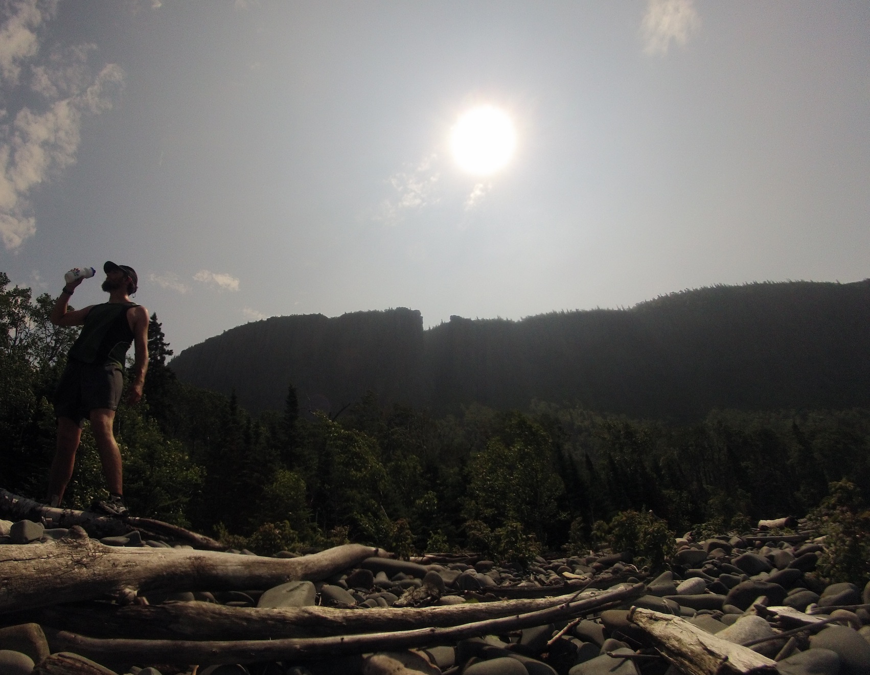
Cliffs rising above the shore of Lake Superior – probably my favourite spot in Ontario
At the tip of the peninsula was the Thunder Cape Bird Observatory. We decided to make the short trek out there to check out the observatory tower and its great view. We got out there, but the low mist/fog didn’t reveal too much as we looked back towards the feet of the Giant. We took a few pics, my brother did his standard yoga photo, and we retreated back to our running loop.
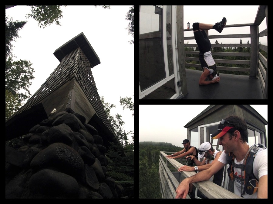
The Tower at Thunder Cape Bird Observatory

Climbing down over the Sleeping Giant’s feet
Climbing back up to, and over, the feet had the most significant climbing of the route. There were a few short, steep sections that we power hiked over, and soon we were on the east shore and heading back towards the trailhead. The rugged singletrack continued for about 3.5km as we climbed up and over the boulders on the lower edge of a massive talus field that marks this side of the Giant. After picking our way through this section, we were at Lehtinen’s Bay and back on the very well trodden trails that made up the last 8km of our run.

Big rocks on the lower edge of the Talus Field

Final stop at Tee Harbour
After a brief stop at Tee Harbour (always my favourite campsite), we were ready to hammer out the last 6km to the parking lot. This was the section of trail I spent most of my time on when I was young, and it was cool to recognize spots and recall memories from many trips there in all seasons. The km’s ticked by quickly on this wide portion of trail, and before long I was headed up the familiar rise to the trailhead parking lot. I got there first and prepped some cold beers for the rest of my crew.
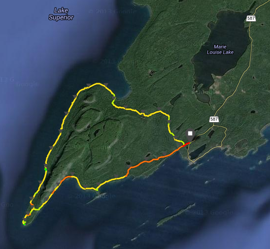
Our route around the Sleeping Giant
The whole route ended up being close to 30km (28.5 on my Suunto Ambit) and even with a bunch of stops we finished in about 4hr20min. It was a great day, with great friends. My life has been really hectic lately, and I haven’t been super motivated to run longer distances since my 50 Miler in May. This was a perfect way to wake me up and get me excited to run again.
I definitely want to get back and try pushing the speed a bit and see how fast I could get around the same loop. I laughed a few times at how long I used to spend out there (days) to do only a portion of that trail. Under heavy packs we were more interested in being away from home than logging serious distance.
I’d love to hear of others that have run this, or other routes around the Giant and what kinds of times you have logged. Maybe my 4:18 is a super soft Fastest Known Time?!

The vast expanse of Lake Superior
The sun came out and dried up all the rain…

Thanks for putting up your trip details. I ran the Giant’s loop from Tea Harbour on August 7th, 2013. My total time was 3hrs 42Mins. I know I was slow on climb up to Talis from Sawyer Bay and was thrown into bushwacking mode when I went right instead of left at the lakehead. I couldn’t agree more with your west coast comparison. The floor of the Forrest is quite comparable with what one would find in a coastal trail like West Coast Trail. I would love to beat this time next year.
Pingback: Kent’s Blog – Running on Vacation | runbikerace·